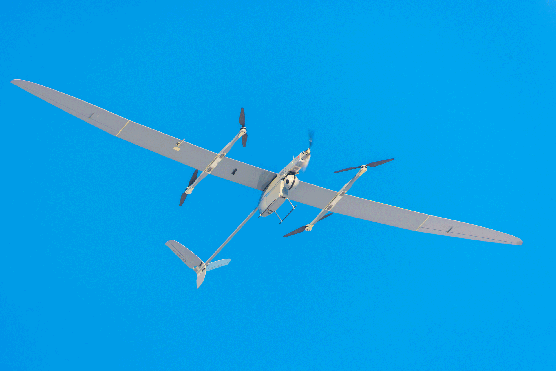
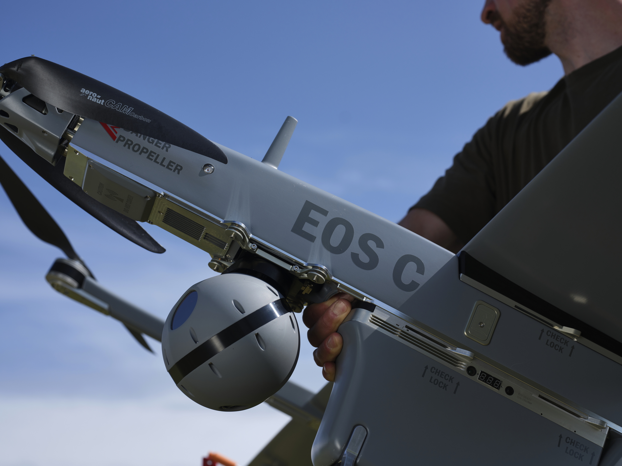
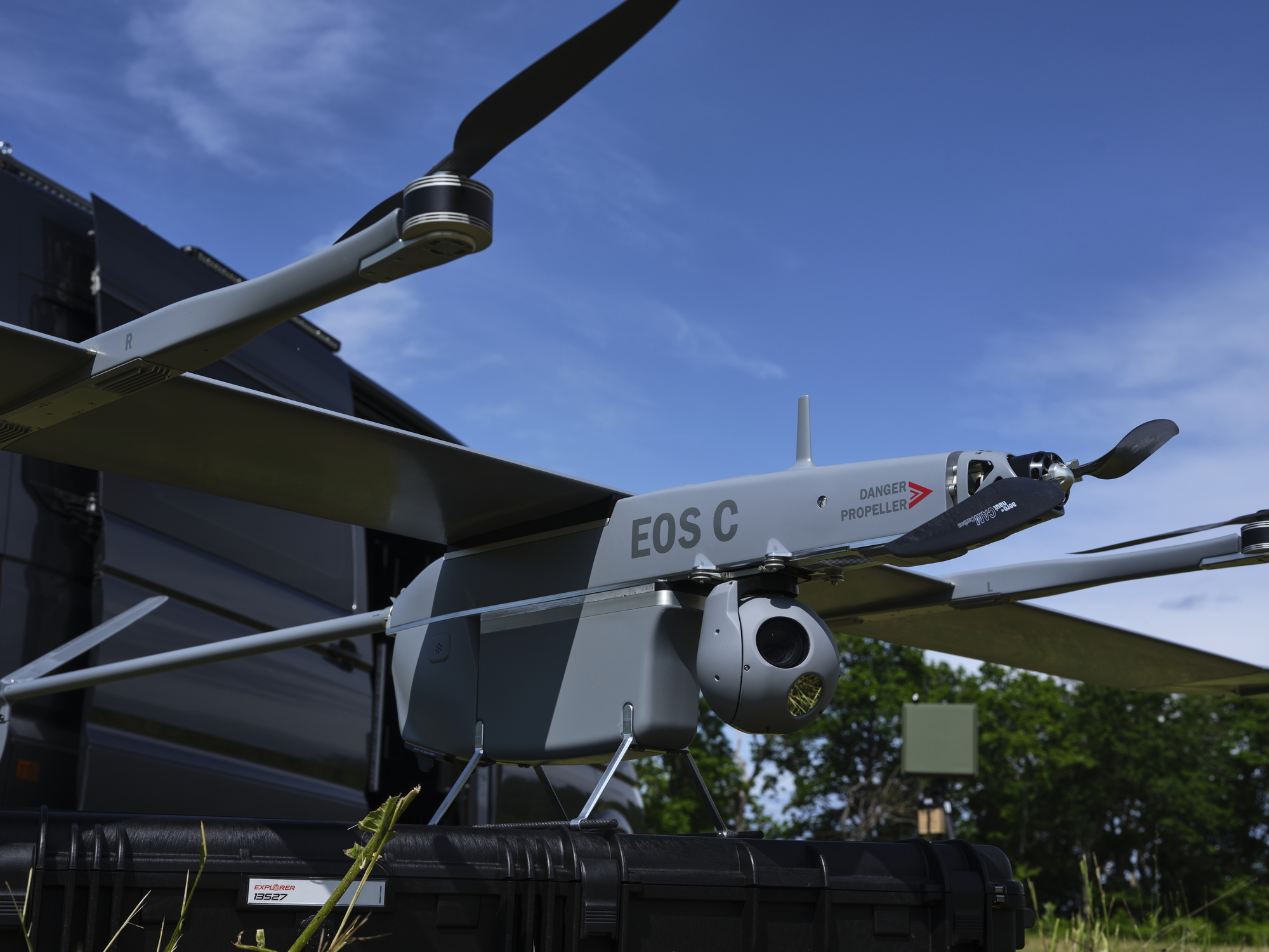
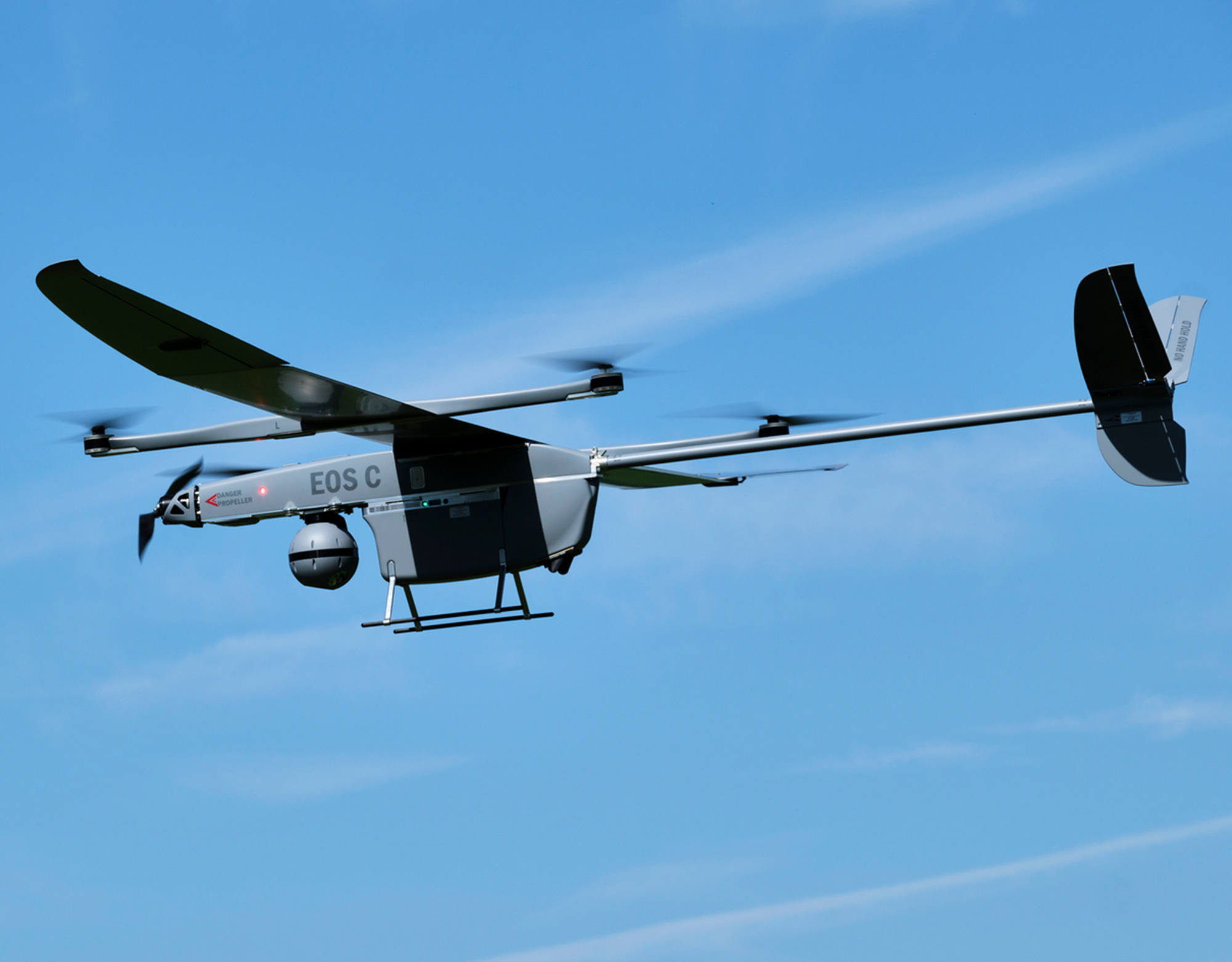
- Eos
- C
- VTOL
FULLY ELECTRICAL UNMANNED AIRCRAFT SYSTEM
Eos C VTOL is a long-range surveillance and target acquisition UAS designed for low observability, endurance, and reliability in the toughest conditions.
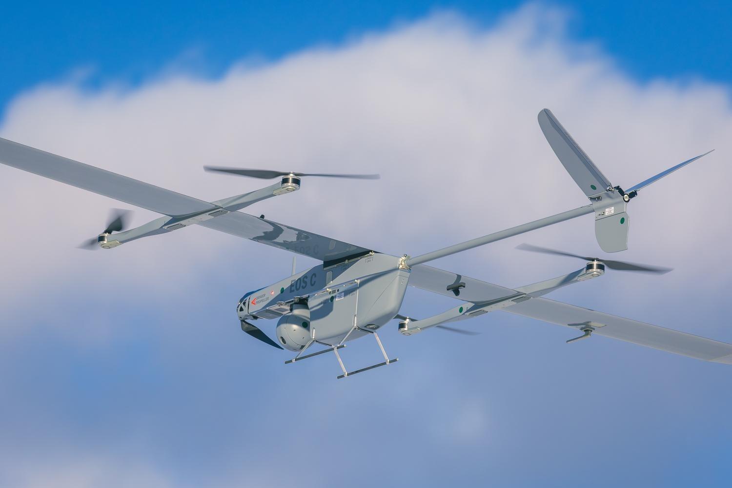
Eos C VTOL is Effective, Reliable, and Easy-to-Use

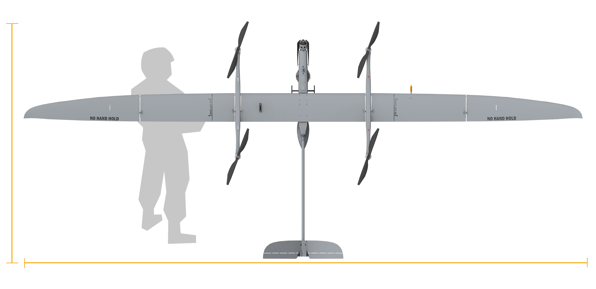
Deployment and operation
- 2 operators required
- 4 minutes from transport to flight
Flight performance
- 50 km operational range (RLOS)
- Endurance: 3 hours
Capabilities
- Navigation without GPS
- EW resistant communications
Key Features
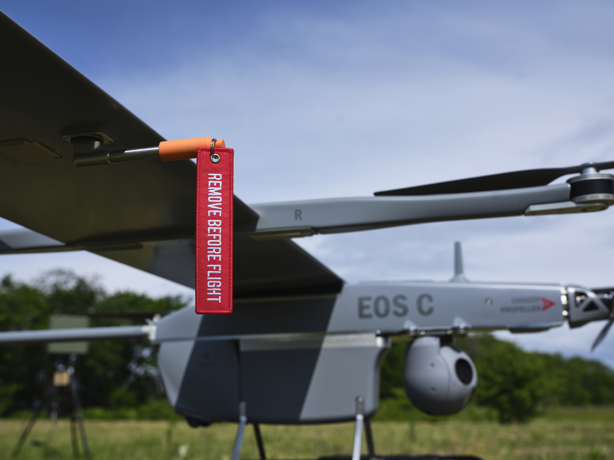
This is how the mission-ready setup looks like
Field-ready by design, the standard configuration includes the Eos C VTOL aircraft, eOpic-5 payload, a ground control station and a ground data terminal.
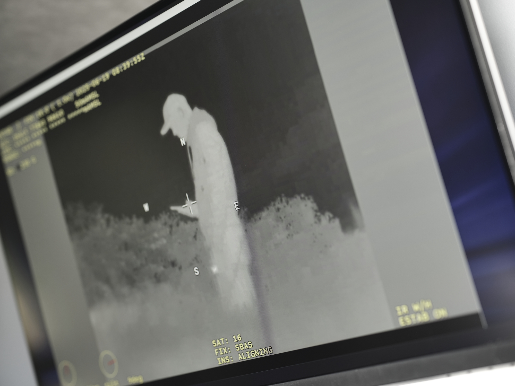
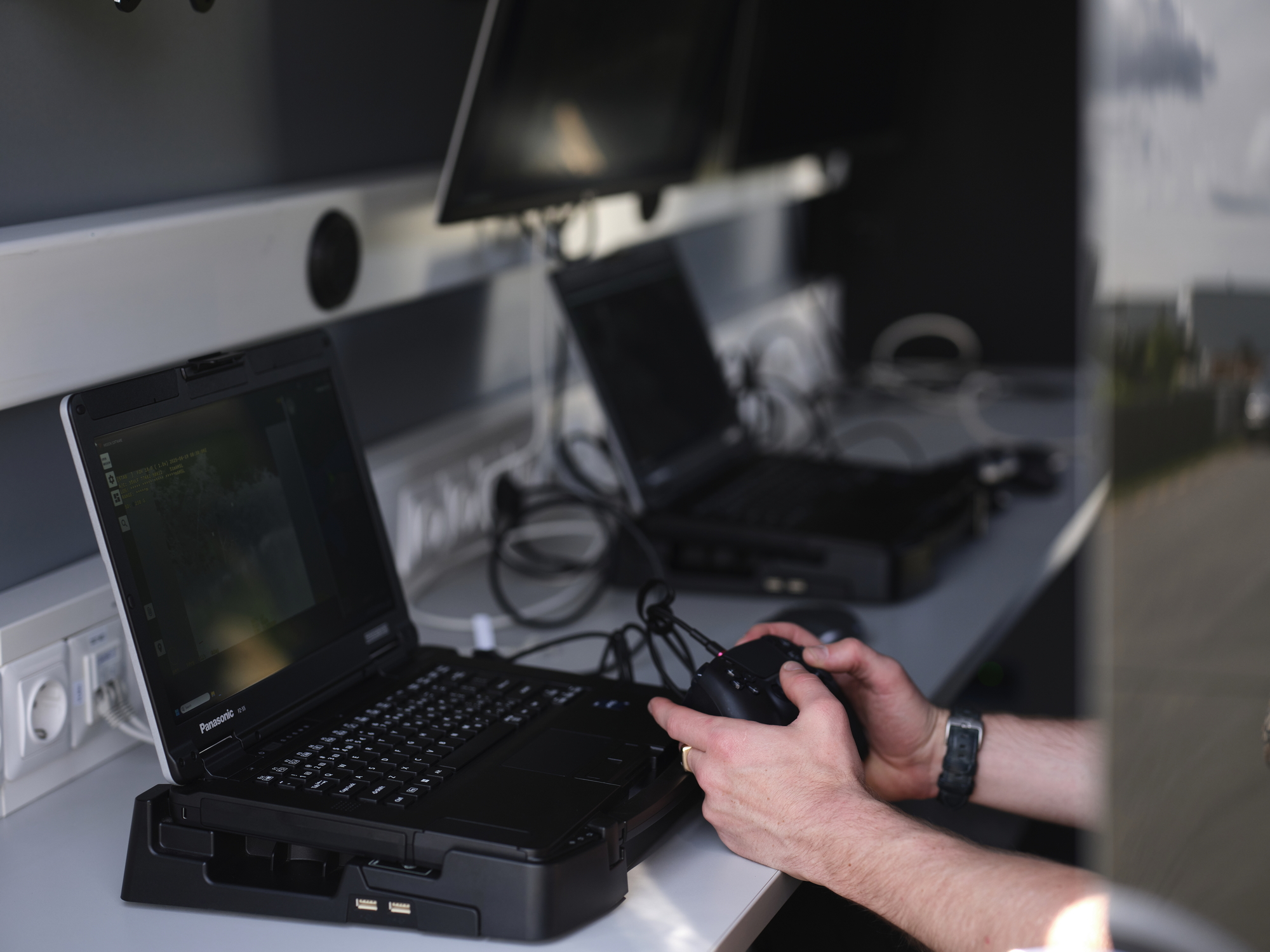
Ground control station (GCS)
Threod’s in-house developed pilot and mission software delivers a full mission management environment, combining aircraft control, real-time monitoring, mission planning and execution, as well as payload operation in one intuitive interface.
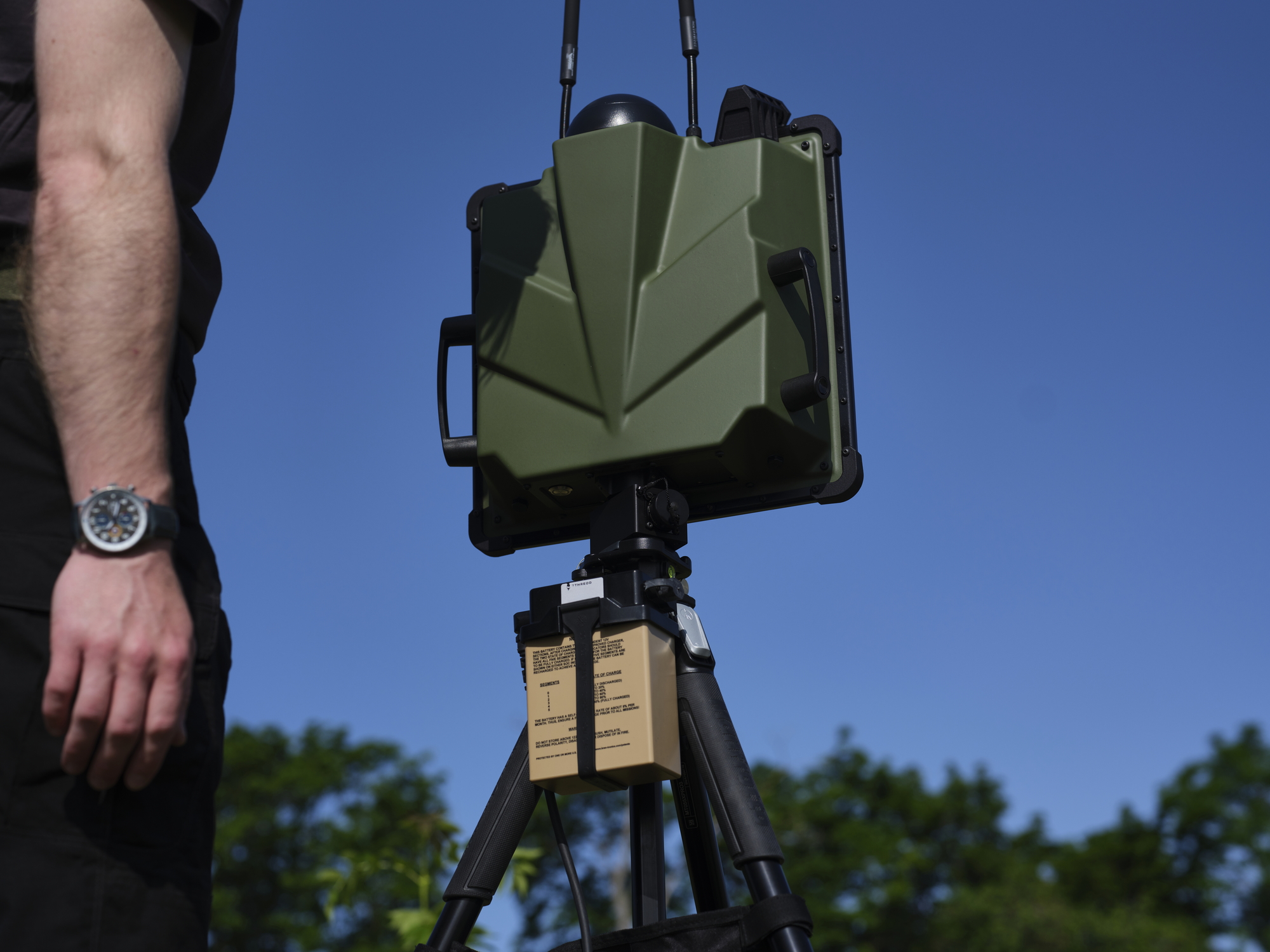
Ground data terminal (GDT)
Threod provides modular ground data terminal solutions optimized for a variety of mission profiles and communications ranges. With renowned radio technology and advanced anti-jamming systems, it maintains control and communication with aircraft even under active electronic warfare attacks. All terminals offer encrypted full-HD video, C2 data link, and full interoperability with Threod’s payloads and mission software.
Optional system features
Enhance the system with optional features to meet mission-specific requirements.
IMSI catcher
IMSI catcher mobile phone detection is ideal for border zones and restricted areas, the system detects over 1,000 mobile devices per minute within a 4 km radius. It tracks movement patterns, generates real-time alerts on unauthorized presence, and enables wide-area monitoring without the need for multiple systems.
Vehicle Ground Control Station
Supports up to 3 operators with backup power, AC/heating, and full system transport – ideal for fast-paced missions and off-grid operational zones.
Training program
Technical specifications
Performance
-
Flight parameters
Endurance 3 h Maximum distance 190 km Communication range 50 km (RLOS)
-
Speed parameters
Cruise speed 61 km/h Max speed 90 km/h
-
Altitude parameters
Service ceiling (AMSL) 4 500 m Max takeoff altitude (AMSL) 3 500 m
-
Weather parameters
Precipitation 10 mm/h Wind penetration 16 m/s Vertical flight wind tolerance 12 m/s Temperature -20°C …+50°C
Communication
-
Communication
Frequency 2.2–2.5 GHz or 4.4–4.9 GHz Bandwidth 5 / 10 / 20 MHz Encryption AES-256 Range Up to 50 km RLOS Type Digital, MIMO / MANET / MESH
-
Anti-jamming
Interference cancellation Interference avoidance GNSS-independent navigation Optional anti-jamming system with CRPA antenna
Flight Control
-
Autopilot
Fully autonomous Waypoint navigation Fly-by-camera mode Geo-fencing
-
Safety
Programmable failsafe routes Automatic return to home
-
Failsafe routes
Dead reckoning Continuous health monitoring Servo and ESC feedback
Operational
-
Deployment
Vertical takeoff and landing
-
Takeoff/Landing Site
Obstacle-free area, 10 × 10 m
-
Instrumentation
GPS / GLONASS / GALILEO Barometric altimeter, radar altimeter Pitot tube with drain Inertial Navigation System (INS) Servo feedback and logging ESC telemetry and logging
-
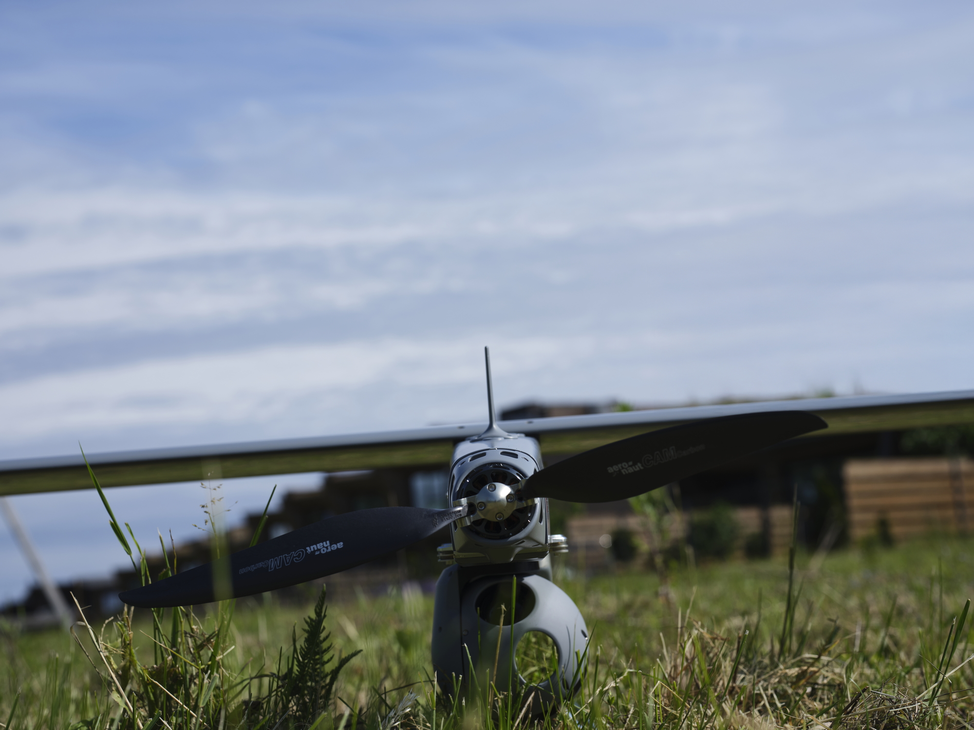
Propulsion
Fully electric / battery powered
-
Air Traffic Control Transponder
Optional Mode-S / ADS-B Out
-
Emergency tracking
Optional GSM / GPS tracker
-
Visibility
LED navigation and anti-collision lights IR strobe / light
-
Battery
Lithium-polymer smart battery with BMS Automatic self-storage feature
Also Worth Exploring
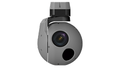
The eOpic-5 is a light-weight dual-axis gyro-stabilized electro-optical system designed for advanced ISR missions.
Explore